Why Àban?
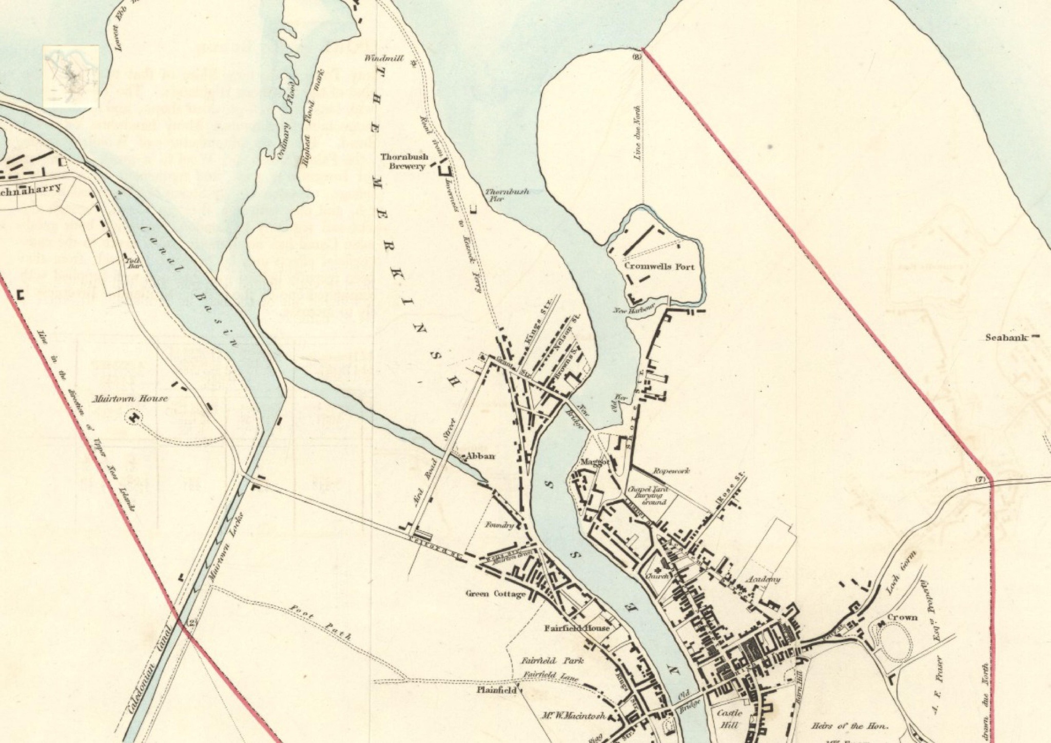
Until 1870, a journey to Merkinch would have crossed over the Àban, a small channel running from the Ness to the sea. Amidst the hustle and bustle of the modern city, we like to pause and remember that nature is never far away - under our feet, in fact.
Abban (The) An t-Aban
NH 660 457
57°2.901'N 4°14.194'W
Àban is a Gaelic place-name element found only in the Inverness area. It means a backwater or disused/silted-up channel. The Abban was one of the features of the old River Ness delta, isolating Merkinch on its W side, and is remembered in Abban Street which runs along the line of the ancient watercourse. Home's map (1774) gives it as 'a saltwater lake called the NABON' (misunderstanding the Gaelic article), and a large field to its immediate south as DALNABON i.e. Dail an Abain. The Abban was filled in during a street development programme in 1870, and then itself developed for housing.
Extract from Place-names of Inverness & Surrounding Area
Credit: Roddy Maclean / NatureScot